Features
Mapping the world... one plant at a time
|
BG-Map
Features Mapping the world... one plant at a time |
|
"You Don't Need to be a GIS Expert to Use BG-Map..."
"The implementation of the software (BG-Map) went very well for us. We were complete by the end of August, and C. has been mapping all of our new garden renovations this year. It's almost intimidating how much the software can do."
Peter Couchman, Executive Director, High Glen Estate
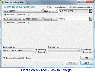 Plant Search Tool - Quickly find mapped or unmapped plants using various search criteria. Use the results to create reports and maps.
Web Interface - With Web-VQF,
display maps, plant information and more on your website or internally for your staff. Plus, Web-VQF supports online horticulural
classes, including the publishing of class materials in PDF format.
Plant Search Tool - Quickly find mapped or unmapped plants using various search criteria. Use the results to create reports and maps.
Web Interface - With Web-VQF,
display maps, plant information and more on your website or internally for your staff. Plus, Web-VQF supports online horticulural
classes, including the publishing of class materials in PDF format.
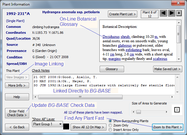
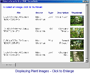 Image Linking - Links to images stored either in BG-BASE or BG-Map - clear thumbnail display of available images for any plant or taxon.
"I have worked with BG-Map for six years now, and I still don't know where I would be without you and your fabulous technical support. From the silly questions to the really tough problems I come up with, you are always willing to talk me through it or get back to me quickly. You never shrink form creating new solutions for the special needs of Mt. Cuba Center. We have a much stronger plant records department as a result."
Amy Highland, Mount Cuba Center
|
List of Software Products from BG-Map...
|
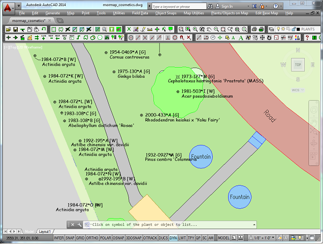
BG-Map is the only available mapping product that links directly to BG-BASE™ without the need for exporting or importing. - Changes entered into BG-BASE are immediately displayed on the map.
![]() Things you can do with BG-Map...
Things you can do with BG-Map...


© 2024 Glicksman Associates, Inc. All rights reserved