
Notes and Suggestions for Botanical Garden Surveyors - Part 1
ByWalt Dunlap, Mapping Specialist, The New York Botanical Garden
As a mapping specialist at The New York Botanical Garden and a professional land surveyor for the last 20 years, I am offering consulting services on land surveying to any garden that is mapping or planning to map their collections or garden.
|Setting Up Control Points| |Grid and Coordinate System| |Using a Total Station|
Setting Up Control Points
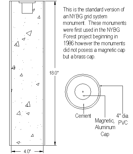
The basis of an accurate map is a network of in-the-ground control points (monuments) with coordinate values set locally or referenced to a larger grid scheme. The network points ought to be of a permanent nature, such as iron pipes, iron rods or brass tablets embedded in concrete or stone. (Editor's note - for more information on how to construct control points, see"Questions and Answers Involving Construction and Installation of Survey Markers").
Local survey custom and availability usually dictate both the type and size of these monuments. They should be coordinated by a closed and adjusted traverse. If software for balancing a traverse cannot be obtained, a basic land surveying text can be used as a reference for the required mathematics.
Establish the control points with an eye to their accessibility and convenience for plant location throughout the site. It is not imperative to locate every plant from a permanent control point. Temporary points may be used us long as their coordinate positions are confirmed by measuring to known or permanent points. More on this later.
Grid and Coordinate System
The underlying theory of coordinate mapping is the Cartesian System, which supposes an East-West (or X) axis intercepting a North-South (or Y) axis at an Origin (point 0,0). The origin may be assumed to be physically distant from the mapping site. For sake of convenience, all coordinate values for your site should be positive X (East-West) and positive Y (North-South).
Many surveyors assume a coordinate value at the southwest corner of a site to be 5,000E and 5,000 N or multiples thereof regardless of the unit of linear measure, feet or meters. This usually assures that all coordinates will be positive and that you always work in a quadrant entirely northeast of the Origin.
All objects on the site can be assigned X,Y coordinates to set their relative position on the grid and to create a map. Object coordinates will reflect the accuracy employed to set their surveyed positions. The accuracy of their location can be gauged by the number of decimal places employed. There is little need to use 3 or 4 decimal places in feet if you are using a compass and tape to measure your locations, even though you can compute them as such. Plants hardly need to be located to better than 1 decimal place in the case of feet (especially if you are estimating center points). But, solid objects, whose location is accurately reproducible, may require 2 places. It's a judgement call.
The same principle applies to elevations, the Z component of an object. On natural ground, there is usually no need to carry more than one decimal place in feet. (Editor's Note: BG-Map assigns an accuracy of 2 decimal places to all coordinates, whether in feet or meters.)
Using a Total Station
BG-Map, for a total station, uses an azimuth and distance method to establish object coordinates. The beginning azimuth is derived as a computation of the direction of a line from the instrument setup point to a backsight point, both of which have known coordinates. The azimuth is generally Grid North-based and rotates through 360 degrees in a clockwise direction: East being 90 degrees, South being 180 degrees and West being 270 degrees. By setting up on a known point and sighting a known point and by turning an angle, one can set the relative azimuth of an object from the setup point. Then, by adding the measured distance component, the coordinates of the object are derived for mapping relative to all other points on the reference grid.

In the illustration the grid is in units of 5 and the backsight point has a coordinate value of 5,000 East and 5,030 North. The instrument occupies 5,025 E and 5,005 N. The computed azimuth to the occupied point is 135º-00'-00", and the distance is 35.56 units. The observed azimuth to the plant is 53º-07'-48", and the distance is 25.00 units, and its calculated coordinate value is 5,045 E and 5,020 N.
There are alternatives to the use of total station electronics, including the use of baselines with offsets and bearings with distances (either in a traverse from plant to plant or from known grid points in a radial direction to plants). In any event, coordinate values are the goal, no matter how derived.
Elevations (Z Coordinates)
If the vertical component (the Z value) is needed, then an adjusted level loop should he made near or through the horizontal control paints. The datum for the loop is defined as the basis for the relative elevations and may be assumed or derived from published values.
The use of a vertical component is available with BG-Map and presupposes a rod height equivalent to the instrument height if you use a total station. Your plant location technique may use many different heights for the mirror in order to most easily measure to a stem and the height of the glass must be reckoned accordingly, either adding or subtracting from the assumed equal height with the instrument. (Editor's Note: In BG-Map, this is can be done by setting a vertical offset.) Each setup point must have an elevation assigned to it, preferably by a closed loop to ensure that there are no errors.
Keeping a Field Notebook
It is important to keep a field book of notes (see illustration above). This practice will offer an opportunity to keep a log of work accomplished and also permit cross-checking your work between office and field. This is especially important if two or more people are cooperating on the data entry and field work.
The illustration shows important details about a particular setup. Use a page-numbered book. Show the date, the setup point and the backsight with its azimuth. By writing down the azimuth, you can often later reconcile any conflicts with the expected position of the points. Write down the azimuth, distance and coordinates of any new control points, whether permanent or not. You may or may not choose to keep track of elevations. But, if you do, don't forget to note the instrument height (HI) and the mirror height (R). The accession number may or may not be noted as you go. Be sure to include any informative notes about the object located, such as length, width, diameter, etc. Use the allowable NPO symbols, and number them for each setup, keeping track of their distinctive features. (Editor's Note: NPO symbols are used in BG-Map to map Non Plant Objects, such as roads, paths, and utilities.)
Use as much space in your notebook as you need to be comfortable with the results. Lastly, it's a good idea to sight a permanent object and note its azimuth in case you temporarily lose your azimuth reading due to battery failure in the total station. It can save a walk back to the backsight and allow the instrument operator to recover the azimuth without help.
-TO BE CONTINUED-
Updated August 30, 1999
![]()